Campus Trails
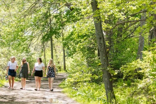
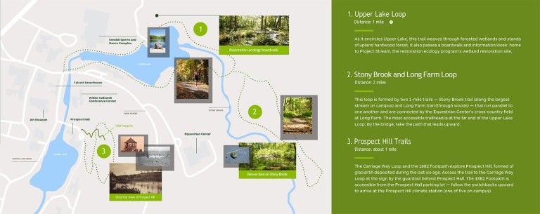
The campus trail system grants access to the various ecological sites located within Mount Holyoke’s campus living laboratory, and provides students and the larger community with miles of trails for both recreation and learning. Several of the trails feature interpretive sites ranging from Prospect Hill’s historical conversion from parkland to forest, to the water quality and wetland restoration story along the Upper Lake loop.
Our trails
The most accessible trailhead for the Upper Lake Loop is near the entrance to the Kendall Sports & Dance Complex and the dam and waterfall on Upper Lake, just after crossing Park Street. The loop is approximately one mile long and primarily circles the entire lake. The loop will take you past the lake and its bordering wetlands and some stands of upland hardwood forest. Wetlands along the lake border include marsh, scrubby wetlands, and some small stands of forested wetlands. The loop will also take you past the Restoration Ecology Program’s wetland restoration project, identifiable by the boardwalk and information kiosk. In addition, a vernal pool borders the trail just above MacGregor Hall.
The Stony Brook Trail is also accessible from the Upper Lake Loop.